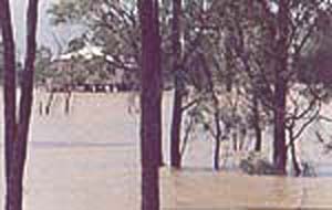
Flood Waters at Laurel Bank....1991
Mt.
Zion was one of the small landmarks of the area. Unfortunately the area has
been significantly quarried and this landmark which was once riddled with caves
and provided exploring territory for the locals is now hardly recognisable in
the landscape. It is located on the corner of Mackenzie
and Sheldrake Roads.
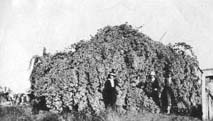
During
the intense heat of summer, the locals trained Bouganvillea over trellises and
used these as outside retreats from the heat. Temperatures in the shade were
significantly cooler than in the house or outside.
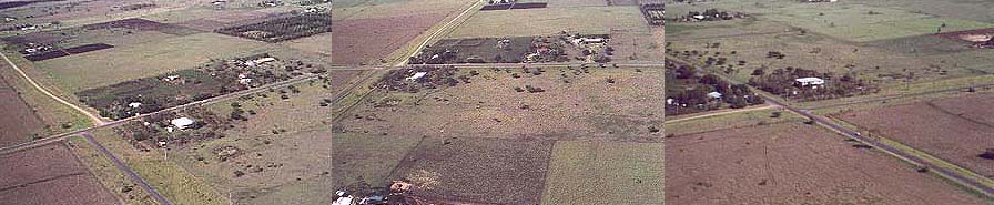
These
aerial views provide a good understanding of the physical nature of this area
called the DOWNS. Today, much of the land which was marked with light schlerophyl
forests suffers from overgrazing and deneuded paddocks. Also much of the larger
divisions have been subdivided into smaller blocks for primarily rural living.
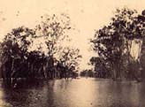
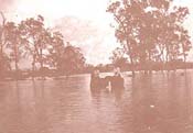
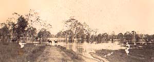
Floods in 1954 saw Alton Downs residents taking
a punt down river to Lion Creek to collect fresh food. Since this flood the
river's banks have become heavily wooded with Coolibahs and prevented this
access in 1991.
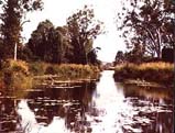
One
of the valuable landmarks to the area are the lagoons that form part of an district's
watering system within the area. They are a integral part of the district's
eco system. Waterlillies in blue, pink and yellow are prevalent as well as turtles.Drovers
used to camp and water stock at the lagoons before being driven into town to
the sale yards. Most of these lagoons have disappeared
from the landscape due to the concurrent dry seasons. Many birds can be found
watering and nesting. The reserve at Long Island is a protected habitat for
the Pygmy Magpie Geese.

Traditionally named Toonooba, the Fitzroy River
runs through the heartland of the Darumbal Tribe, which has lived in the area
for more than 19,000 years. The river and lagoons have given up fish, turtles,
eel and mussels. Long Island was pronounced a Reserve for Public Purposes
in 1869 and leased for stock grazing. Residents of Alton Downs used to gather
at the Angle for picnics. Others would take their
Dray and collect river sand for building construction. The Reserve is now
an Environmental Reserve with the aim to restore the area to a self sustaining
eco system. The River serves as the northern border of this area.
There is very little evidence of the original architecture
of thedistrict. Successive floods have washed away many of the dwellings.
Floods have been recorded in 1859, 1864, 1875, 1890, 1896, 1918, 1928, 1940,
1954, 1991. While most were built from tin and timber on the lower reaches
of the flood plains, they were not built high on stumps like many other
Queenslander homes as the shifting black soils prevented this. Even today
as you drive through the district look at the tank stands and the high set
houses and you will be amazed at the tenous angle of the supporting stumps.
The Tower of Pisa pales into insignificance. Extensive stock losses were
experienced at flood times.
..............FLOODS
The
river has broken its banks at Laurel Bank on the Ridgelands Road, 1918
While
cut off from Rockhampton, the locals threw cast nets for fish in the flood waters.
The
impending rain from MacKenzie Rd looking North.
The
road closed at Laurel Bank and Ridgelands Rd.
People
and stock were kept supplied by Army helicopter.
DROUGHTS....have
been recorded in1885, 1902, 1915, 1919, 1926, 1931, 1940's with lack of rain,
wells dried up
The
intersection of Mackenzie and Hunts with Ridgelands Road
The
story is that Drought put an end to the growing of cotton in the district as
it needed a lot of water. In 1902 only 15" rain fell and goats were the
only surviving animals - hence goat meat and milk were used. Water was rationed,
even well water. A severe mouse plague accompanied this drought. In the 1940's
drought many animals were lost. Farmers who had bottle trees would saw them
up and feed them through chaff cutters for feed for their animals. Branches
off trees were special and animals would horn each other just to get to the
leaves. Irene Tyrrell remembers the 1940's drought . They had 130 head and lost
all except 8. Even the horse she learnt to ride on at 5 years died as a result
of the drought.


